

Climate Adaptation: How much space do we give water?

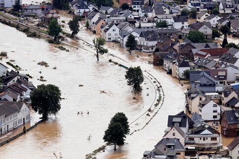
Five years after the devastating floods in the Ahr Valley, climate adaptation means looking beyond individual buildings to properties, settlements and river landscapes. How much space do we give water?
Reconstruction as an Opportunity for Greater Resilience
The flood disaster of July 2021 marked the starting point for a challenging reconstruction process. Destroyed buildings and infrastructure were not simply to be replaced, but planned and built to be more resilient. The KAHR research project "KAHR-KlimaAnpassung, Hochwasser und Resilienz" accompanied this process from 2021 to 2025 and developed recommendations ranging from flood-resilient buildings and retention areas to critical infrastructure and settlement development. Reconstruction is understood as an opportunity to reduce existing vulnerabilities rather than reproduce them.
Five years later, the question can be framed more broadly. Climate adaptation is by no means limited to river valleys. According to the Prognos study “Climate-Adapted Buildings”, the investment required to adapt Germany’s building sector by 2035 amounts to €137 billion under a moderate climate change scenario and €237 billion under a severe climate change scenario. Heavy rainfall alone accounts for €65 billion and €76 billion, respectively. For river flooding, the figures are €1 billion and €5 billion.
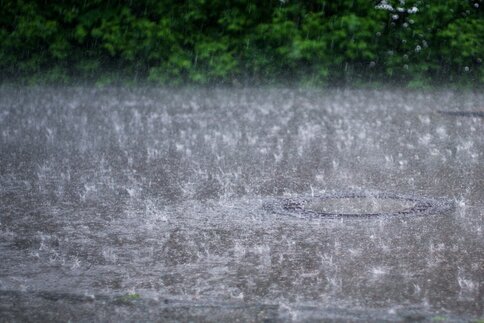
Heavy rainfall affects large areas
The major difference in the distribution of damage can be explained by the different spatial distribution of risks. River flooding is primarily concentrated in known high-risk areas. Heavy rainfall, by contrast, can occur almost anywhere. Topography, soil sealing, development and drainage influence where water flows and where it accumulates. Prognos therefore also distinguishes between the strategies required. In the case of river flooding, higher-level municipal measures play an important role, while heavy rainfall preparedness must also take the individual property and building into account. Basements, underground car parks and basement-level apartments are particularly vulnerable, as are increasingly ground floors.
The greater challenge for the construction sector, however, lies not in new construction. According to Prognos, 86% of the adaptation investments required for existing buildings by 2035 under a moderate climate change scenario will go towards existing buildings. This is where new requirements meet long-established structures, properties and settlement patterns.

Knowing where the water comes from
A reliable understanding of the risks is the starting point for any adaptation strategy. The KAHR project therefore places particular emphasis on flood models as well as heavy rainfall and flash flood hazard maps. They show potential inundation areas, water depths and flow paths, providing the basis for preparedness and spatial planning.
For architecture and urban planning, the real challenge begins with translating this information into spatial decisions. Where can water be retained? Which flow paths need to remain clear? Which uses are appropriate in areas at risk? Such questions can only be answered to a limited extent once buildings, access infrastructure and plot layouts are already fixed. In existing neighbourhoods, retention and infiltration areas have to compete with many other demands on the same space: access, technical infrastructure, mobility, open space and new development.
Avoid, resist, adapt.
At building level, three basic strategies are available: avoid, resist and adapt. These range from the choice of location and elevation, to sealing vulnerable parts of buildings, to structures and uses designed to withstand temporary flooding with as little damage as possible. The third strategy in particular changes the design approach.
Sensitive uses and technical equipment can be relocated from areas at risk, materials selected according to their water resistance, and lower parts of buildings designed so that they can be more easily restored after an event. For critical infrastructure, maintaining functionality is an additional consideration. Here, the potential damage to the building is not the only factor; the consequences its failure would have for the surrounding area must also be considered.
KAHR therefore deliberately extends flood-resilient buildings to further scales of planning. The practical guide addresses topics including managed settlement development, retention basins, protective structures, bridges, multifunctional spaces and renaturalisation.
Water needs space
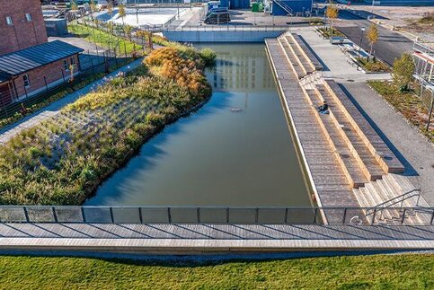
This has a clear spatial consequence. Water that is retained or allowed to infiltrate either does not reach buildings at all or does so with reduced impact. Retention areas, unsealed surfaces and open spaces can help reduce peak runoff. At the same time, spaces within settlements can serve multiple purposes and be temporarily activated for water retention during heavy rainfall events.
Such spaces are particularly scarce in existing built-up areas. Additional development, transport, technical infrastructure, open space and water management all have to be accommodated within a limited area. Climate adaptation therefore becomes a matter of balancing competing demands long before the structural details of an individual building are determined. Even more fundamental is the choice of location. KAHR identifies managed settlement development as a distinct field of action. The decision where new development takes place and which uses should be kept out of particularly vulnerable areas influences future susceptibility to damage just as much as subsequent building-level protection.
Reconstruction without reproducing past vulnerabilities
In the Ahr Valley, this ambition must contend with existing settlements, ownership structures and considerable time pressure. While homes, transport routes and infrastructure need to be restored quickly, long-term decisions on flood protection and settlement development require considerably more time.
This is precisely where KAHR identifies a key challenge in reconstruction: it begins immediately and takes place simultaneously at many levels. Decisions made early on can limit future options for flood protection and reducing vulnerability. The research project sets the principle of “Building Back Better” against this. Reconstruction should not reproduce the same physical, social, economic and institutional conditions that proved vulnerable during the disaster. KAHR’s first scientific recommendation therefore takes a broad approach. Reconstruction should become the starting point for a “strategic transformation process”. This includes climate-adapted spatial and settlement development as well as a new approach to managing rivers. Simply restoring the previous structures is not enough.
From damage repair to prevention
Five years after the flood, the challenge can be defined more precisely. Risks can be modelled in greater detail, building strategies are known, and planning tools are available. Prognos also shows the scale of investment required for adapting buildings alone. However, the key questions often arise before the design of individual buildings. They concern flow paths and retention areas, properties and infrastructure, settlement development and river landscapes. KAHR therefore calls for greater prioritisation of investment in flood protection and climate preparedness, and for a shift in focus from repairing damage to preventing it.
Further Reading
- “Klimaangepasste Gebäude – Zukunftssicherheit und Wachstumschance für die Bauwirtschaft”, Prognos, commissioned by the Zentralverband Deutsches Baugewerbe (ZDB) and the Bundesverband Deutscher Baustoff-Fachhandel (BDB), 2025.
- “Nach der Flutkatastrophe: Chance für Veränderungen – Ein Praxisleitfaden mit Strategien und Beispielen für Kommunen”, Deutsches Institut für Urbanistik (Difu), as part of the KAHR research project – KlimaAnpassung, Hochwasser und Resilienz, 2025.